Hood River, Oregon
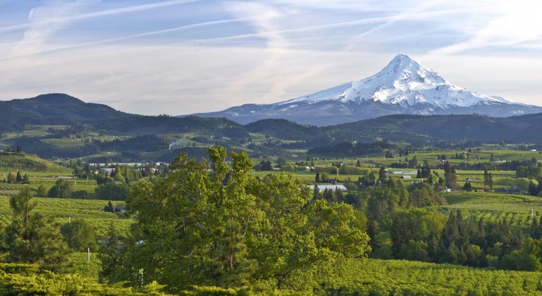
Oregon’s Columbia River Gorge has world-famous wind. The canyon walls climb as high as 4,000 feet in sections and funnel consistent and strong flows into the sails and kites of the windsurfers and kiteboarders that stipple the river. Hood River, Oregon happens to be the epicenter of that wind. But dependable wind isn’t the only draw to the area, Hood River is a launch point for skiing on Mt. Hood, mountain biking around Mt. Hood National Forest, rafting and fishing the Deschutes River, cycling on majestic roadways, hiking and exploring the Historic Columbia River Highway, and even wine and beer tasting throughout Oregon’s blossoming haute-beverage scene. And that is just in Oregon; the state line runs down the Columbia River, so just over the bridge lies a whole new bounty of rivers, roadways, restaurants, vineyards, mountains, and trails in Washington. Be prepared for adrenaline in Hood River and watch out for any untethered clothing.
Maps
-
Map of the Highest Points in Each of the 50 States
Many have heard about the state highpoints quest and contemplated it over a beverage or two. An experienced mountaineer or even someone who is fit and very determined could do most of the peaks. You could even get a little help, like on Rainier where climbers often use a guide service. Denali in Alaska however, is in […]
-
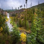
11 Stunning Waterfalls in Oregon
Oregon might have the highest concentration of beautiful waterfalls in the country. Several other states would probably consider those fighting words, but we will let you judge for yourselves. Silver Falls east of Salem Some of the Oregon waterfalls are well-known like Multnomah Falls along the Historic Columbia River Highway. There are about 20 other […]
Featured Mountains in Hood River
| Mountain | Approx. Elevation |
|---|---|
| Wygant Trail | 912 ft (278 m) |
| Panorama Point | 692 ft (211 m) |
| Mount Hood (State High Point) | 11,239 ft (3,426 m) |
| Lost Lake Butte | 4,459 ft (1,359 m) |
| Hood River Mountain | 2,392 ft (729 m) |
| Bald Butte | 3,763 ft (1,147 m) |
| Surveyors Ridge | 3,737 ft (1,139 m) |
| Stanley Rock | 243 ft (74 m) |