Mount Stuart looks out over the Teanaway and Yakima River valleys in rural Kittitas County, Washington. From the summit, the views extend from Mt. Adams to Mt. Baker and practically every inner-Cascade range in between. Stu is one of the tallest non-volcanic peaks in the state at 9,415 feet and said to be a solid chunk of granite. The combination of high elevation, good rock, and steep faces makes it one of the most popular multi-pitch rock climbs in the state. It features several different routes and is considered a true prize no matter the grade you choose to climb.
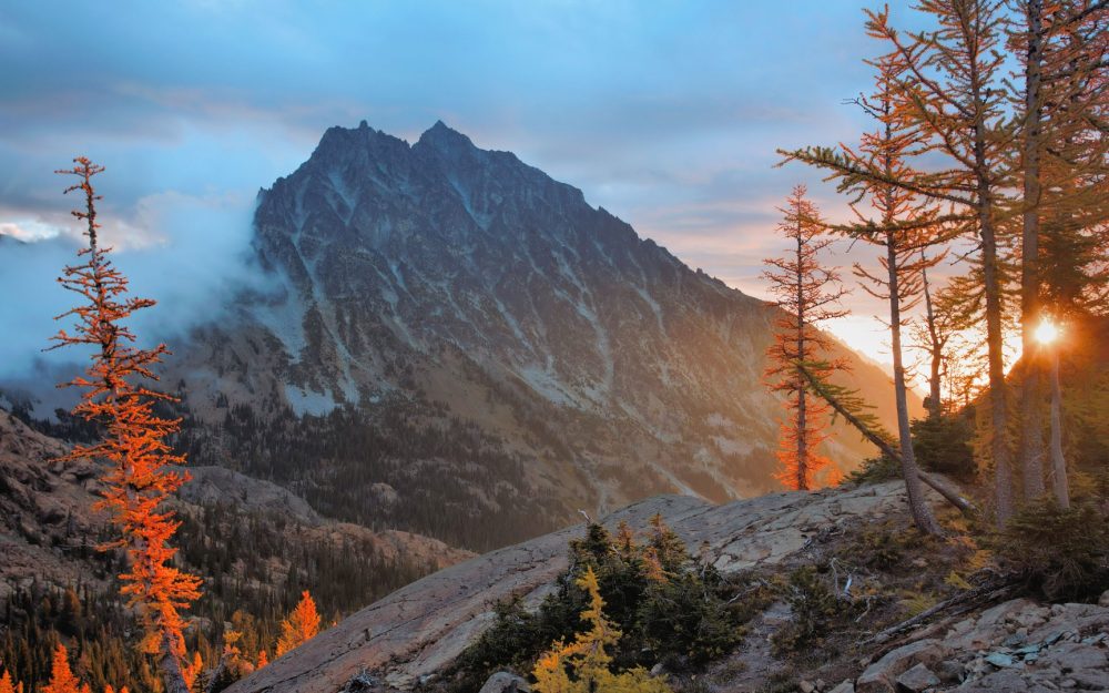 Mount Stuart
Mount Stuart punctuates the western end of the Stuart Range. The eastern end gradually declines on Wedge Mountain before reaching the foothill town of Leavenworth, WA. Right in the middle of the Stuart range is a high alpine plateau called the Enchantment Basin, home to about ten small lakes that are frozen most of the year. Surrounding these lakes are several high peaks, known as the Enchantment Peaks (or simply the Enchantments) that qualify for Washington’s Bulger List. Since these peaks are close together and relatively easy climbs, they are a peakbagger’s dream.
On a two night trip a few years ago we tackled six of the Enchantments with ease. Our route started at the Mountaineer lot, ascended to Colchuck Col (between Colchuck and Dragontail), then exited via a bushwhack off the north side of Cannon and returned to the car. Because it was early season (before permits are required), we camped in the snow at the col and in the basin and didn’t see another soul. The other three peaks we climbed were Little Annapurna, McClellan, and Enchantment Peak.
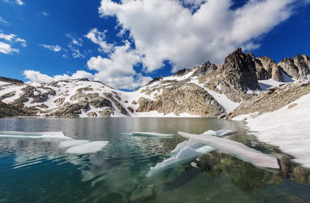 Lakes, bergs, and mountains in the Enchantment Basin
Camping requires a permit from May 15th to October 31st and permits can be obtained by entering in the pre-season lottery. A few permits are saved for day-of reservations on a first-come, first-served basis. More about the season and permits can be found on the National Forest website.
If there is a stable weather window, we highly recommend hitting it pre-season to avoid crowds, bugs, and bureaucracy. Crampons, axes, and warm gear is a must early season. If you wait until summer, the snow will eventually melt, revealing a footpath that meanders through the basin for hikers, backpackers, and photographers.
Aasgard Pass is the main north route to Stuart and into the Enchantments (note that it is mislabeled on USGS topo maps as Colchuck Pass). The trailhead is at the end of Mountaineer Creek Road and is called the Stuart Lake Trailhead. You can access the previously mentioned Colchuck Col from this trailhead as well. Another northern entry heads up the Snow Creek valley to the basin from the Snow Lakes Trailhead. Both of these trailheads are accessed from Icicle Creek Road. The third entry to the Enchantments is the Ingalls Creek Trailhead off Blewett Pass Highway (Hwy 97), but this is usually for climbers heading to Stuart. The map above shows these three trailheads. Hikers can use either of the northern trailheads to enter the basin after the snow has melted.
Mountains on this map
| Mountain | Elevation |
|---|---|
| Mount Stuart | 9,415 ft (2,870 m) |
| Sherpa Peak | 8,605 ft (2,623 m) |
| Argonaut Peak | 8,453 ft (2,576 m) |
| Colchuck Peak | 8,705 ft (2,653 m) |
| Dragontail Peak | 8,840 ft (2,694 m) |
| Little Annapurna | 8,440 ft (2,573 m) |
| McClellan Peak | 8,364 ft (2,549 m) |
| Cannon Mountain | 8,638 ft (2,633 m) |
| Enchantment Peak | 8,520 ft (2,597 m) |
| Prusik Peak | 7,858 ft (2,395 m) |
| The Temple | 8,035 ft (2,449 m) |
| Wedge Mountain | 5,781 ft (1,762 m) |
Landmarks on this map
| Stuart Lake Trailhead |
| Snow Lakes Trailhead |
| Ingalls Creek Trailhead |