Remote rivers pose a unique access challenge. You either have to pare down your gear and run them in whatever you are willing to haul in on your back, or work out a complicated scheme, usually involving more than one mode of transport, to get as close to the water as possible.
Thankfully, Washington’s remote Stehekin River is the latter. I’ve never run the Stehekin River, but it has been on my radar after compiling a list of potential overnight “duckie” (otherwise know as an inflatable kayak) trips last year.
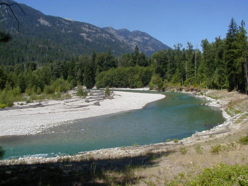 The Stehekin River
The run is 10-miles of beautiful class II water that feeds right into Lake Chelan. There are no roads around the lake, which is 55 miles long and stretches into the southern portion of the Stephen Mather Wilderness (part of North Cascades National Park). The only access is via ferry (which leaves once a day) and then via bus from Stehekin, making the most challenging portion of this run actually getting there and back.
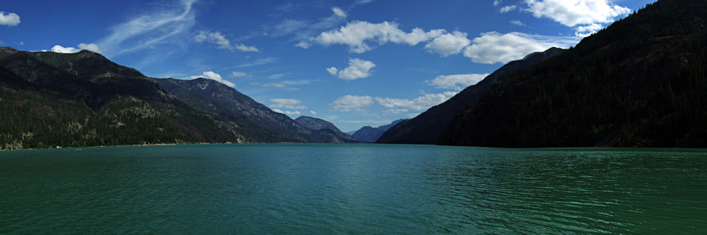 Lake Chelan in all its glory. Photo: Philip Fortes
I started where most of my river scouting starts – American Whitewater. The river database is an excellent planning resource featuring potential routes, pictures, coordinates, river warnings, gauge links, and whatever beta the community offers up. I wanted to stretch the run as long as possible to get an overnighter in, but after reading about the class IV section above High Bridge and the class IV/V gorge run if you continue up Agnes Creek (the tributary that enters at High Bridge), High Bridge seemed like the aptest place to start. The run from High Bridge to the mouth is about 10 miles – definitely doable in a day but could stretch into an overnighter with a leisurely pace and some fishing.
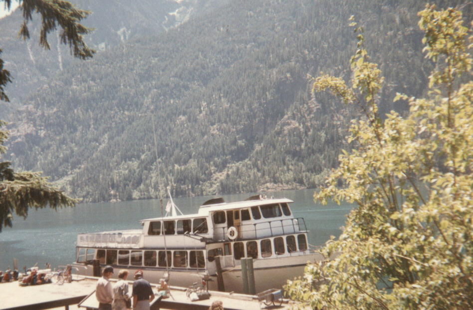 The Lady of the Lake back when it was single boat operation in 1989. 100 years ago before this photo was taken, the first boat was put into service on Lake Chelan. Photo: Robert Ashworth
Now how do we get there? The Lady of the Lake ferry takes care of the 55-miles across Lake Chelan with a 2.5-hour express route for $61 round trip or a 4-hour non-express cruise for $40 (both leaving from the town of Chelan). Unfortunately, both boats leave at the same time (8:30 am) so morning travel is the only option. They do charge a freight fee of $6.75 per 75 lbs, so I’d imagine I’d be shelling out at least double that for our deflated tandem kayak and all the necessary gear.
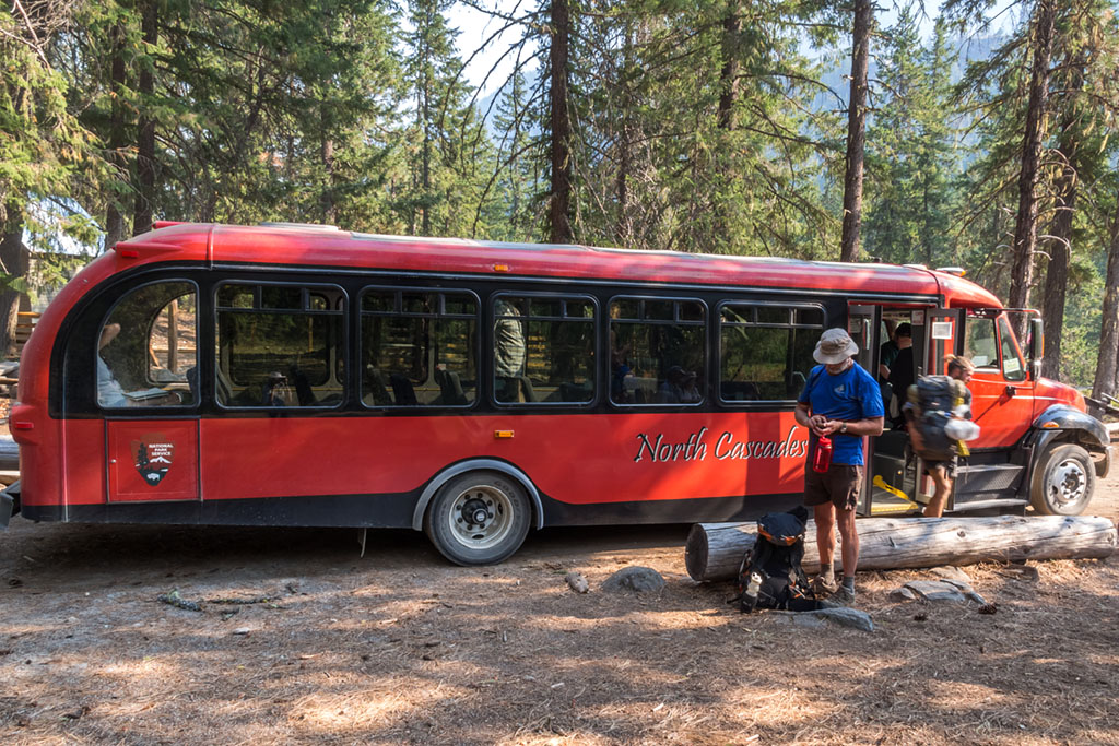 Backpackers hitch a ride down on the Stehekin Valley Shuttle at High Bridge Campground. Definitely room for a boat or two. Photo: Brian Byrd
The Lady of the Lake drops you off at Stehekin. From Stehekin, there is a bus (Stehekin Valley Shuttle) that makes the 11-mile drive up to High Bridge four times per day (8 am, 11:15 am, 2 pm, 5:30 pm). It takes about an hour with all the stops. The fare listed on National Parks website is $5 for a one-way trip. So the express ferry would put on on the 11:15 am bus and the standard ferry puts you on the 2 pm bus, with a bit of time to spend in the town of Stehekin. You could also take advantage of this all-day bus schedule to do a few laps if the river is really moving – just a thought.
Next, camping. I pulled up the land designation maps from 3 different and strangely contradictory sources: Washington’s Public Lands Map (WPLM), which shows how the state is carved up by federal, state, DFW, DNR, and city/county; University of Montana’s Wilderness.net, which is map of the country that shows the wilderness designations, names, and boundaries; and lastly, Oregon and Washington’s Bureau of Land Management GIS Map (BLM), which allows you to toggle through an overwhelming amount of map layers and data points and is not as intuitive as the others.
WPLM lists the area along the Stehekin River as mostly federal land with a few spots of unknown or private. Wilderness.net had the Stehekin River valley marked as separate from the Stephen Mather Wilderness and therefore outside of federal land jurisdiction. BLM offered the most confusing map where the “unknown” designation was peppered along the entire river’s edge; it could be private, it could be public, but the only thing for sure is that it is a mystery to the Bureau of Land Management.
Dispersed camping in National Forest is allowed but in National Parks it might get you into trouble. The mountains around Stehekin are part of the Chelan National Recreation Area, which has another set of rules for dispersed camping (designated locations only).
Personally, I would opt for Occam’s razor – as long as I don’t see signs denoting private property and I’m not greeted with gunfire, I’ll assume the land is “unknown” and therefore the perfect place to make dinner, watch the stars, and greet another day. As with any land, the unknown should still be treated with respect – leave no trace.
If you have a fear of the unknown or how a Stehekinite hermit might react to surprise company, there is a campground that appears to abut the water at river mile 3.5: Harlequin Campground. Playing it safe is an option, but it only leaves 3.5 miles of water for the next day, so this a good choice for laps or to catch the noon or 2 pm ferry back to Chelan.
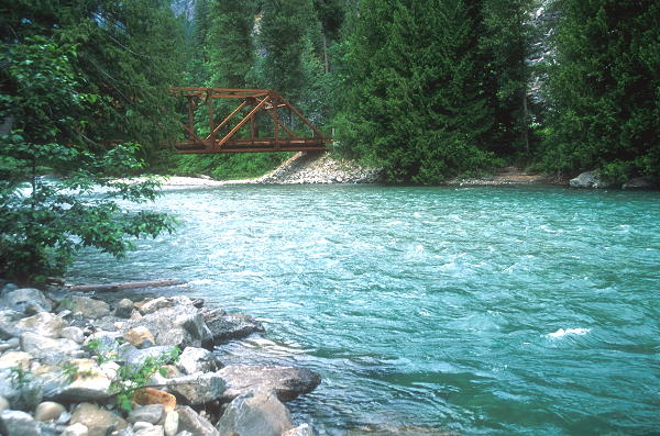 Harlequin Bridge 3.5 miles from the mouth.
The Stehekin River flows into Lake Chelan about 1.3 miles from the ferry landing as the crow flies. You have the option of paddling directly across the lake or hugging the shoreline for a slightly longer journey (about 2 miles). Either way puts you right back at the dock, ready to pack up your boats in front of curious tourists, who will undoubtedly strike up a conversation sometime during the 4-hour boat ride. Make some new friends; they probably have tons of snacks.