Imogene Pass has eluded me. Although I’ve been planning a trip to ride up to Imogene’s 13,114-foot marker for some time now, I still have never been over this treacherous pass in the San Juan Mountains. High elevation backroads draw me in like glaciated mountains used to when I was a younger mountaineer. I have ridden over Ophir, Cinnamon, California, Weston, and other unimproved passes in Colorado, but I have yet to tackle Imogene Pass.
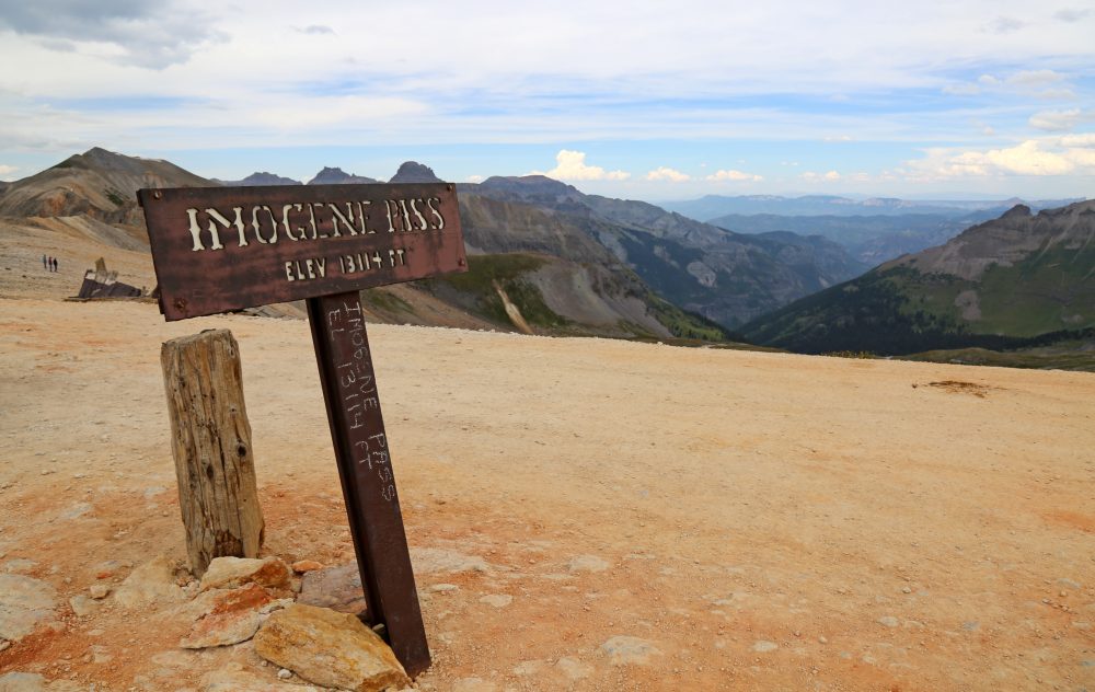 The Imogene Pass Summit sign. The air is thin up here!
My preference is to ride over Imogene on an adventure motorcycle, but if I happen to be in the area in my 4×4 rig, I would still make a run at it. From what I understand, it would be a difficult mountain bike ride or a long, challenging trail run, but there is an annual run that draws many participants who want to race against the clock for about 17 miles and over 5000 feet of elevation gain.
Imogene Pass climbs up over a gap just below Chicago Peak and Telluride Peak between the mountain towns of Telluride and Ouray. This old road was put in place to access mines on both sides of the pass, some of them near the summit. I’m a fan of old ghost towns and this route has several including Tomboy, Camp Bird, and Sneffels, where settlement foundations and other mining artifacts remain. I would budget time to explore each of these historic locations.
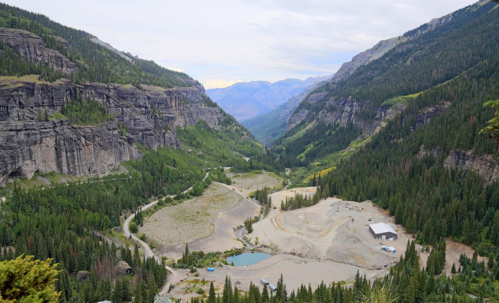 Camp Bird in the Canyon Creek Valley looking in the direction of Ouray.
There are certainly photogenic vistas along the way, but the views from the 13,114-foot pass are outstanding – lush, sweeping valleys creep up the colossal Rocky Mountain peaks until the brisk alpine takes over. Many of Colorado’s famous 14ers are visible from the pass. I can’t wait to take it all in.
Another reason this trip calls to me is that I know there are inherent risks. Like many of my adventures, it’s always a bigger accomplishment if I know there are hazards involved. The roads up Imogene Pass are steep, rocky, narrow, and seriously exposed (“pucker up butter cup”). Having experience driving or riding these types of roads is important because Imogene could lead to vehicle damage, personal injury, or much worse. I look forward to the challenge.
In preparation for this trip, I have combed the internet for trip reports and information, watched numerous YouTube videos, and printed a topographic map of the Imogene route. One of these summers after the snow is cleared on the route, I will make the trip to southwest Colorado to get Imogene and other nearby high passes. Black Bear Pass is within striking distance and just as challenging (or more so I’ve heard!).
Please Note: As stated above, I have actually never been up Imogene Pass. Although all the information, coordinates, and beta provided is based on thorough research, it is by no means a complete guide and should be supplemented with your own research about the route, mines, ghost towns, and activities. If you have firsthand experience with potential hazards, little-known discoveries, or find any of this information completely wrong, please let us know.
Mountains on this map
| Mountain | Elevation |
|---|---|
| Telluride Peak | 13,481 ft (4,109 m) |
| Chicago Peak | 13,343 ft (4,067 m) |
Landmarks on this map
| Trailhead in Ouray See details |
| Trailhead in Telluride See details |
| Imogene Pass See details |
| Tomboy Ghost Town See details |
| Camp Bird Ghost Town See details |
| Upper Bird Camp Ghost Town See details |
| Sneffels Ghost Town (Side Trip into Yankee Boy Basin) See details |
| Forest Road 361 (Camp Bird Rd) |
| K 68 Road (Tomboy Rd) |