Oroville, Washington
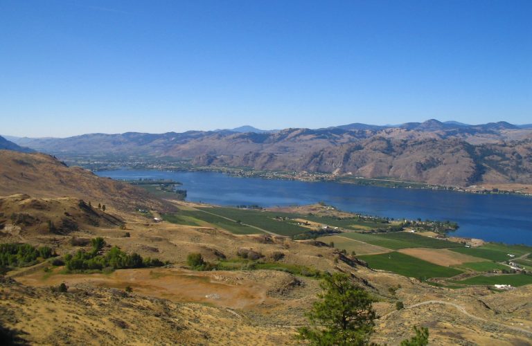
Just four miles from Canada, Oroville is the biggest border town in the Okanogan Valley. With gold in its name (Spanish word oro), the town had a prosperous role in Washington’s late-1800s gold rush. It sits on the multi-national Osoyoos Lake – a fairly large, shared waterway that extends at least eight miles into Canada. The surrounding hills are full of remnant mines and gold claims as well as ghost towns like Molson and Nighthawk. Sitzmark Ski Hill is just 20 minutes from town if you need a quick snow fix, but the 650-feet of vertical probably sends most serious riders west to the Cascades. The Similkameen River, featuring a seldom-traveled-yet-worthwhile Class 2 overnight float trip, feeds into the Okanogan River just south of town and is a highlight for fisherman as well as boaters. With its lake, river systems, and mining history, Oroville is a border town worth a deeper look.
Maps
-
Washington Backcountry Discovery Route
The Washington Backcountry Discovery Route (WABDR) is a route for adventure motorcycling and overlanding that uses mostly unpaved public backroads to cross Washington State from Oregon to British Columbia. The route climbs over vast mountains and ridges in Washington’s Cascade Range. Four-wheel drive vehicles with high clearance or adventure motorcycles are the required vehicles for […]
Featured Mountains in Oroville
| Mountain | Approx. Elevation |
|---|---|
| Palmer Mountain | 4,291 ft (1,308 m) |
| Mount Bonaparte | 7,257 ft (2,212 m) |
| McDonald Mountain | 3,970 ft (1,210 m) |
| Kruger Mountain | 2,743 ft (836 m) |
| Ellemeham Mountain | 4,344 ft (1,324 m) |
| Barker Mountain | 3,924 ft (1,196 m) |