Dillon, Colorado
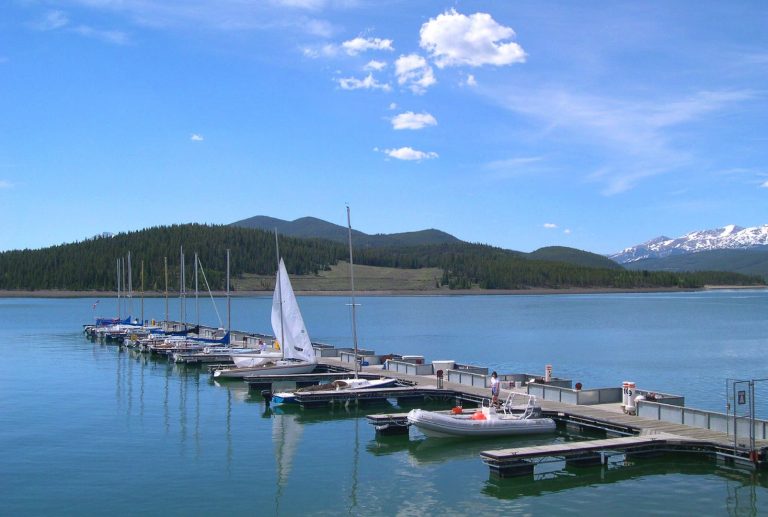
Sailing at 9,017 feet? Hop on the Dillon Reservoir – also known as Lake Dillon – and you are on your way. The town of Dillon sits on the northern edge of the lake and hosts a marina and some great alternatives to the ritzier I-70 hotels and restaurants. Keystone Ski Resort is right up the road and the White River National Forest, which transitions into the Arapaho and Roosevelt National Forest just past the 14ers Greys (14,278 feet) and Torreys (14,275 feet), offers plenty of year-round backcountry access. Being the closest town to Keystone, Dillon sees a fair amount of winter traffic, but is most popular in summer with people looking to get out for a sail, kayak, SUP, or to kiteboard on its stunning high-elevation reservoir.
Maps
-
A User Guide to Summit County Colorado
Sandwiched between the continental divide and a spectacular array of 13- and 14,000-foot mountains, Summit County boasts the highest elevation stretch of I-70 as it crosses central Colorado. With four world-class ski resorts, multiple 14ers, one of the main headwaters of the Colorado River, and an endless amount of alpine terrain, there is a reason […]
Featured Mountains in Dillon
| Mountain | Approx. Elevation |
|---|---|
| Torreys Peak | 14,267 ft (4,349 m) |
| Tenderfoot Mountain | 11,443 ft (3,488 m) |
| Swan Mountain | 10,768 ft (3,282 m) |
| Ptarmigan Peak | 12,497 ft (3,809 m) |
| Lenawee Mountain | 13,186 ft (4,019 m) |
| Independence Mountain | 12,559 ft (3,828 m) |
| Grays Peak | 14,270 ft (4,349 m) |
| Glacier Mountain | 12,401 ft (3,780 m) |
| Coon Hill | 12,716 ft (3,876 m) |