Cedar Mesa is home to the well-explored Grand Gulch as well as many other lesser-known canyons filled with Anasazi ruins, artifacts, and artwork. The area is basically a museum without the hours, fees, and glass cases. At least for now. Cedar Mesa could become part of a huge and heavily-contested proposed national monument in Southeast Utah that would absorb over 2 million acres of land. While the national parks in Utah’s southern canyons are amazing in their own right, they are packed with tourists and park rangers – an obvious distraction from the wilderness experience they are meant to preserve. Cedar Mesa still offers up that pure wilderness, where discovery is endless and you have the freedom to hike, climb, and explore the area at your, hopefully respectful, discretion.
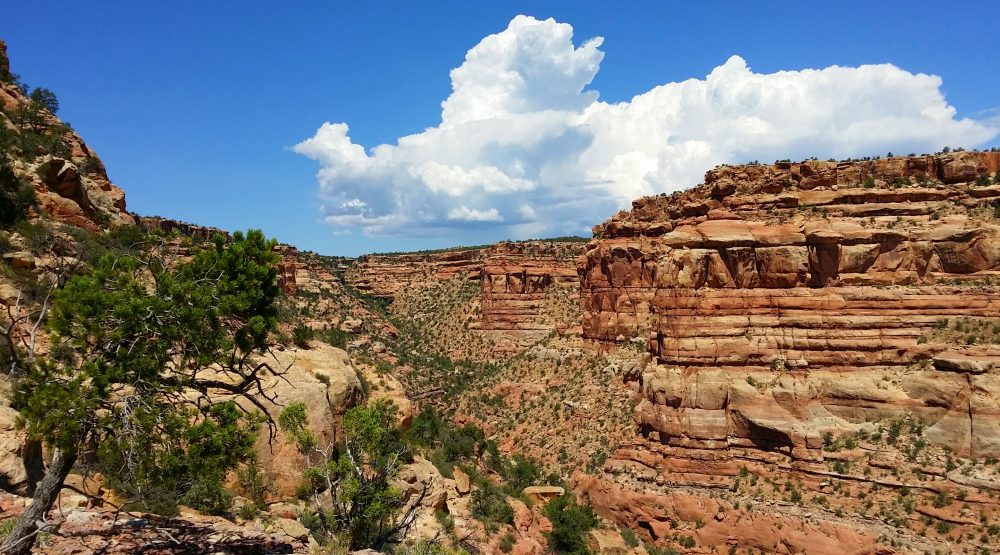 Lower Mule Canyon, photo Bryce Stevens
If you want to visit Cedar Mesa, be sure to research the vast canyon network to decide which area suits your trip. Some are much more difficult to navigate and their treasures inconspicuous. For your first visit, Grand Gulch is a great place to start. It features a wide wash with solid trails and easy access to abundant archaeological sites. If you visit during the mild-weather shoulder seasons (spring and fall), the rangers at Kane Gulch Ranger Station can help answer questions or provide any extra information you may need.
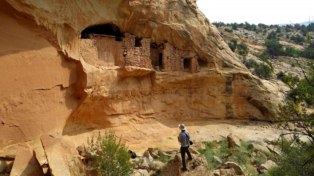 Ruins in Upper Butler Wash, photo Bryce Stevens
The nearby towns of Blanding, Bluff, and Mexican Hat all offer up unique restaurants and hotels if you are looking to spend a night off the red rock. And since looters have stolen all the remaining unbroken cups, bowls, and pots, you should stop by the Edge of the Cedars Museum in Blanding to see some of the intact artifacts that were removed from Cedar Mesa before the looters got to them.
Above is a map that identifies each of the major canyons that drain off Cedar Mesa along with several noteworthy natural arches.
Mountains on this map
| Mountain | Elevation |
|---|---|
| Cedar Mesa | 6,752 ft (2,058 m) |
| Nevills Arch | 5,518 ft (1,682 m) |
| Shaw Arch | 4,583 ft (1,397 m) |
| Stimper Arch | 5,938 ft (1,810 m) |
| Muley Point | 6,230 ft (1,899 m) |
Landmarks on this map
| Kane Gulch Ranger Station See details |
| Upper Grand Gulch |
| Lower Grand Gulch |
| Bullet Canyon |
| Collins Canyon |
| Polly's Canyon |
| Step Canyon |
| Pine Canyon |
| Shiek's Canyon |
| Coyote Canyon |
| Todie Canyon |
| Kane Gulch |
| Slickhorn Canyon |
| Johns Canyon |
| Lime Creek Canyon |
| Road Canyon |
| McLoyd Canyon |
| Owl Canyon |
| Fish Canyon |
| Mule Canyon |
| Moki Dugway - Southern Access to Cedar Mesa See details |