
June 27, 2000

| »Home »Updates »Photos »Route Map »Sponsors |
|||||
Greetings!
This letter is coming from home, as we made it to our final destination on June 20, 2000. We are enjoying the re-adjustment back into the world of man-made conveniences, such as water that's cold when you want it to be cold and hot when you want it to be hot, instead of the other way around; like pillows; like supermarkets (and all that fresh food!); like stereos and telephones.
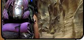
 click for photos from hike |
|
The near vertical canyon walls grew taller as we worked our way through the slick clay, quicksand, and the dense foliage of the canyon bottom. We departed the Dirty Devil, entering into Robber's Roost canyon, a beautiful deep sandstone canyon that we exited by hiking through Angel Arch, an old cattle route that leads to the San Rafael Desert above. Finally, the temperature started mellowing. We didn't melt during the heat wave, but temps in the mid-80s are a lot easier to take and require less liquid consumption, and finding and carrying water was certainly still an issue.
A couple of days on dirt roads left us with only one option for finding water: bumming it off of passing travelers. We knew that people heading out into this region would always have plenty of water, and we figured it would be nice to not have to worry about what was in the water for a change.
We entered our fourth national park on day 93; the Horseshoe Canyon Annex of Canyonlands National Park. We found this canyon to be every bit as stunning as the famed pictograph galleries that it is known for. We also got an amusing little reality check at Horseshoe. When we asked visitors who had hiked down into the canyon if there was any water, they always told us yes, but it didn't look very drinkable and was only in tiny, dirty pools. When we hiked into the canyon the next day, we thought the water was about the best looking water that we had seen in a long while! I guess everything is relative...
We spent a couple of spectacular days working our way down Horseshoe to the Green River. We were greeted by the scene of a recent wildfire at the canyon's junction with the river; apparently a careless boater had allowed things to get a bit out of control. We no longer wanted to spend the night there, the place was a mess, and so we made plans to get across the higher than expected river. We wrapped our vulnerable gear in garbage bags, and filled our two liter water bottles all with air. That gave the backpacks all the buoyancy they needed, we set up our air mattresses and chair kits to act as our floatation device. The water was delightfully warm, the packs were floating well, the day was hot (again over 100°F), so we decided to do the obvious; instead of hiking down the riverbank for 3½ miles, we floated the miles away. It was awesome!! What a beautiful, fantastic way to see a desert canyon! The no boat float!!
|
|
Again, questionable water sources forced us off our intended route; again we found ourselves bumming water from motorists (this time on the access road to Deadhorse State Park and the Island in the Sky district of Canyonlands National Park). Two more days hiking left. We hiked down the side of the paved road in Seven Mile canyon to the highway into Moab. Here we had a day to kill, as the Green River float session put us a day ahead of schedule. We spent the day at a nearby commercial campground, where we were able to shower and take advantage of the little general store's selection of cold beverages and snacks. Arches, our fifth national park and final destination, was in clear view.
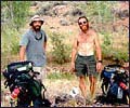
A couple thunderstorms later (the first rain we had seen in almost a month), a couple of friends arrived to celebrate the finish. We camped just outside of Arches, off the old monument access road. On Tuesday, June 20, day 101, we hiked seven miles down Courthouse Wash, to the conclusion of our journey. After many adventures, a couple of scars, and many, many memories, we were done. Our bodies withstood the rigors of the trek, so did our minds, and surprisingly enough, so did our friendship (though it was still going to be nice to not see each other for a while!). After a tasty meal in Moab, Mitch and girlfriend Rachel headed home; Mike went for a rafting excursion on the Moab Daily section of the Colorado River before heading for a shower, a pillow, and a warm greeting from the pooch!!
— Mitch and Mike, MountainZone.com Correspondents
| EXPEDITION DISPATCHES | |
|
|