 The approach to Shishapangma: elevations are in meters and the map scale is 1:50,000. The trekking route proceeds up the Chongdui Valley. Elevations: Mt. Xixabangma (Chinese translation), 8013m; Punga Ri, 7445m; Nyanang Ri, 7071m. [HOME] [DISPATCHES] [MAPS] © 1999 MountainZone.com. All rights reserved. |
Shishapangma: 1999 American Ski Expedition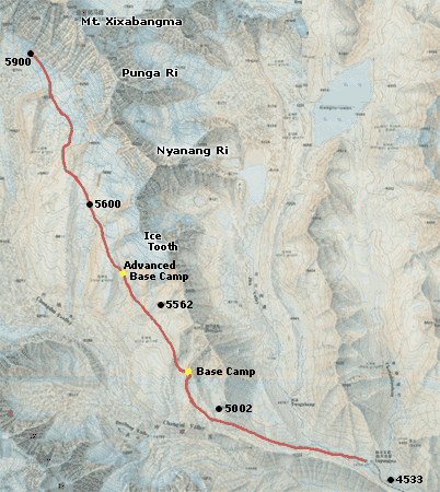 |