
The Adventure Eating Diet
Over the years, traipsing around the globe, a pack on my back and a map in my hand, I've honed the art of something I like to call adventure eating. In the woods, in the mountains, or even on a train from Munich to Garmisch-Partenkirchen in the Bavarian Alps, this style of eating -- which involves quick and convenient calorie consumption, no cooking required -- has saved me time and money, and it has alleviated the headache of constant food preparation at times when I could be doing something much more fun.
Take climbing a mountain, for example. During the aforementioned Bavarian sojourn, which necessitated hiking on the Zugspitze, the tallest peak in Germany, I procured a small cache of bread and brie from the breakfast buffet at my village hotel, built four ad hoc sandwiches, wrapped them in napkins, and headed out the door. The hearty bread and thick, creamy brie cheese, plus two German chocolate bars and some water, satiated and sustained me for the entire day, allowing me to go ultra-light and fast through the tumbling alpine bliss.
Lately, I've become more scientific about adventure eating, reading nutrition labels, counting calories and divvying food up in baggies for per-hour and per-diem ratios. For big adventures, including overnight mountain climbs or marathon backpacking ordeals, I eat at least once an hour and consume 4,000 to 5,000 calories in a day. Each little baggie of food -- which I keep accessible in the hip-belt pockets on my pack -- contains at least 300 calories, and I simply make sure to empty the contents of one packet into my mouth every hour.
Specific food stuffs I've come to rely on include cashews, pecans, pepperonis, croutons, beef jerky, dried fruit, candy bars, Oreo cookies and Pop-Tarts. All of these items meet the adventure-eating-diet criteria of being easy to eat, high-calorie and non-perishable. They are also all quite yummy, which has become an increasingly important factor for me.
Energy bars and gels are fine for short events, I've concluded. But for anything longer than one day my taste buds and tummy start to reject energy food, causing me to eat less, to go slower, and, in many cases, to bonk into helpless bouts of delirium.
Drinking your calories is a big part of the adventure-eating diet, as well. My favorite liquid meals are developed by the likes of Hammer Nutrition LTD, Abbott Laboratories and Novartis Nutrition Corporation. The latter two companies, which respectively make Ensure Shakes and Boost Drink, cater more to the health and geriatric markets, and less to adventurers.
But Boost and Ensure are perfect for anyone who needs quick, good-tasting, easily-downable calories. Both products are sold at your corner grocer. They cost about $1.50 per 8-ounce bottle and embody similar nutritional specifications, with about 250 calories per serving, 5 grams of fat, 40 grams of carbs and 10 grams of protein.
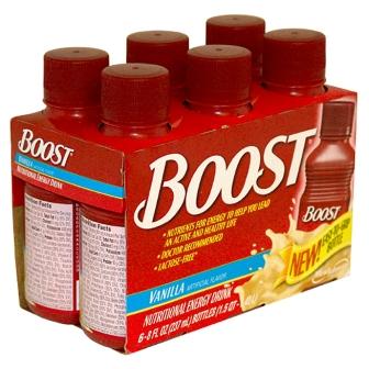
Boost
On the trail, I'll often drink a chocolate Boost or Ensure to wash down a handful of cashews or croutons. It's a three-minute meal, several hundred calories rich, that I can eat while hiking. Energy comes immediately from this kind of nutritional shot in the arm.
More well known among athletes, Hammer Nutrition LTD's Perpetuem drink (www.e-caps.com) has been crucial for me on several adventures. Two scoops of this powder supplement mixes with water to make a fueling shake in your bike water bottle. The creamy orange Dreamsicle flavor, which costs $2.29 per serving, goes down easy and provides 260 calories with 54 grams of carbohydrates, 6 grams of protein, and 2 grams of healthy, adventure-diet-approved fat.
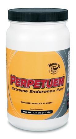
Hammer Pertpetuem
Take climbing a mountain, for example. During the aforementioned Bavarian sojourn, which necessitated hiking on the Zugspitze, the tallest peak in Germany, I procured a small cache of bread and brie from the breakfast buffet at my village hotel, built four ad hoc sandwiches, wrapped them in napkins, and headed out the door. The hearty bread and thick, creamy brie cheese, plus two German chocolate bars and some water, satiated and sustained me for the entire day, allowing me to go ultra-light and fast through the tumbling alpine bliss.
Lately, I've become more scientific about adventure eating, reading nutrition labels, counting calories and divvying food up in baggies for per-hour and per-diem ratios. For big adventures, including overnight mountain climbs or marathon backpacking ordeals, I eat at least once an hour and consume 4,000 to 5,000 calories in a day. Each little baggie of food -- which I keep accessible in the hip-belt pockets on my pack -- contains at least 300 calories, and I simply make sure to empty the contents of one packet into my mouth every hour.
Specific food stuffs I've come to rely on include cashews, pecans, pepperonis, croutons, beef jerky, dried fruit, candy bars, Oreo cookies and Pop-Tarts. All of these items meet the adventure-eating-diet criteria of being easy to eat, high-calorie and non-perishable. They are also all quite yummy, which has become an increasingly important factor for me.
Energy bars and gels are fine for short events, I've concluded. But for anything longer than one day my taste buds and tummy start to reject energy food, causing me to eat less, to go slower, and, in many cases, to bonk into helpless bouts of delirium.
Drinking your calories is a big part of the adventure-eating diet, as well. My favorite liquid meals are developed by the likes of Hammer Nutrition LTD, Abbott Laboratories and Novartis Nutrition Corporation. The latter two companies, which respectively make Ensure Shakes and Boost Drink, cater more to the health and geriatric markets, and less to adventurers.
But Boost and Ensure are perfect for anyone who needs quick, good-tasting, easily-downable calories. Both products are sold at your corner grocer. They cost about $1.50 per 8-ounce bottle and embody similar nutritional specifications, with about 250 calories per serving, 5 grams of fat, 40 grams of carbs and 10 grams of protein.
Boost
On the trail, I'll often drink a chocolate Boost or Ensure to wash down a handful of cashews or croutons. It's a three-minute meal, several hundred calories rich, that I can eat while hiking. Energy comes immediately from this kind of nutritional shot in the arm.
More well known among athletes, Hammer Nutrition LTD's Perpetuem drink (www.e-caps.com) has been crucial for me on several adventures. Two scoops of this powder supplement mixes with water to make a fueling shake in your bike water bottle. The creamy orange Dreamsicle flavor, which costs $2.29 per serving, goes down easy and provides 260 calories with 54 grams of carbohydrates, 6 grams of protein, and 2 grams of healthy, adventure-diet-approved fat.
Hammer Pertpetuem
 Subscribe to Stephen's RSS Feed
 Subscribe to Stephen's RSS Feed