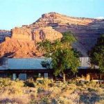
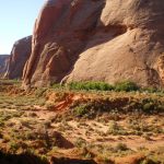
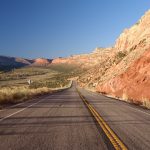
Mexican Hat, Utah
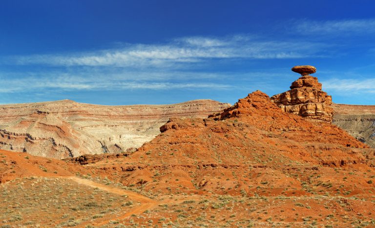
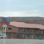
Mexican Hat, Utah, with a resident population of under 100 people, might be the smallest mountain town on the roster. But this tiny town on the banks of the San Juan River is analogous to the experience of the desert southwest: feeling microscopic amidst the towering red rock buttes and mesas, the deep, meandering sandstone canyons, and the parched wilderness that bends to the horizon. If you are looking for a base to explore nearby Monument Valley, The Valley of the Gods, Cedar Mesa, or Goosenecks State Park, Mexican Hat is just the place. There is a famous meat-pendulum barbecue joint, The Swingin Steak, as well as a few laid back lodges and hotels to rest and wash off the red dust. You can also experience the desert canyons by boat on a popular, rather mellow section of the San Juan River that passes through Mexican Hat.
Recent Articles
-
Finding the Lost City of the Lukachukais
Lost cities don’t exist. They are confined to the bottoms of oceans and 19th-century jungles. As children, we all eventually give up on looking for buried treasure in backyards, or undiscovered, ancient ruins down the block because at this point humanity has been around long enough to stumble over most of them. Long before I […]
-
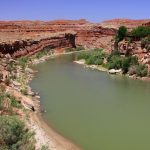
San Juan River Rafting
The colors of the San Juan River near Mexican Hat, Utah The San Juan river is a fun desert float in Southern Utah that can be run in 2 to 7 days depending on where you put in and take out. Most trips launch at either Sand Island or Mexican Hat and take-out at Mexican […]
-
The Battle for The Bears Ears, Part V: A Personal View
This is the fifth and final installment of a series of articles examining protection of Cedar Mesa and the proposed Bears Ears National Monument. On my first day as a ranger I climbed the Bears Ears. Visible more than 100 miles away from my home in New Mexico, they stood like two beacons above the desert, […]
-
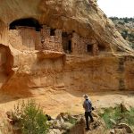
The Battle for The Bears Ears, Part IV: The Trouble With Archaeology
This is the fourth installment of a series of articles examining protection of Cedar Mesa and the proposed Bears Ears National Monument. When it comes to protecting the land, archaeology is the problem from hell. Ruins deteriorate and crumble away, vulnerable to animal disturbance, erosion, and weathering. Looters and vandals can destroy sites just as […]
-
The Battle for The Bears Ears, Part III: Road Wars
This is the third installment of a series of articles examining protection of Cedar Mesa and the proposed Bears Ears National Monument. On Christmas Day of 1879, George B. Hobbs gazed out over Cedar Mesa to contemplate his fate. Along with three other scouts from the Hole-in-the-Rock Expedition, Hobbs found himself without food, on a […]
-
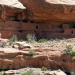
The Battle for The Bears Ears, Part II: The End of Obscurity
This is the second installment of a series of articles examining protection of Cedar Mesa and the proposed Bears Ears National Monument. In his 1996 book In Search of the Old Ones, adventure writer David Roberts described stumbling across Moon House, which he called “The most striking Anasazi ruin I had ever seen”: I had […]
-
The Battle for The Bears Ears, Part I: The Legislative Landscape
This is the first installment of a series of articles examining protection of Cedar Mesa and the proposed Bears Ears National Monument. On a clear day, the Bears Ears offer nothing but peace. The twin buttes stand eerily silent in the thin air, rippled only by a whispering breeze or the cries of a lazy raven […]
Maps
-
Bears Ears National Monument Map
Bears Ears National Monument is a new national monument in southeast Utah, named for the centrally located Bears Ears Peaks. President Obama signed the monument into law on December 28th 2016. The national monument has many wilderness study areas and consists primarily of unprotected BLM land, used heavily by everyone from hikers and backpackers to the […]
-
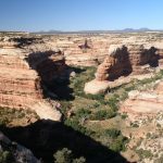
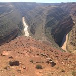
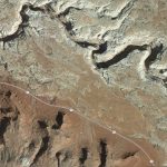
Map of Cedar Mesa
Cedar Mesa is home to the well-explored Grand Gulch as well as many other lesser-known canyons filled with Anasazi ruins, artifacts, and artwork. The area is basically a museum without the hours, fees, and glass cases. At least for now. Cedar Mesa could become part of a huge and heavily-contested proposed national monument in Southeast […]
-
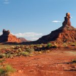
Valley of the Gods
Valley of the Gods is so colorful and uniquely beautiful that it’s fit for kings, queens, and even Gods. That’s if they like dry high deserts which are hot as hell in the summer and damned cold in the winter. This place is so special that BLM designated the road through it as a scenic […]
-
The Black Hole of White Canyon
Most of us have a list of exotic, dangerous, ambitious, and even mysterious items we want to do before we kick the proverbial bucket. On a recent trip to explore the canyons of Cedar Mesa in southeast Utah, I was able to cross one trip off: the notorious Black Hole of White Canyon. We were […]
Featured Mountains in Mexican Hat
| Mountain | Approx. Elevation |
|---|---|
| Scotchman Butte | 4,814 ft (1,467 m) |
| Cedar Mesa | 6,752 ft (2,058 m) |
| Bell Butte | 5,351 ft (1,631 m) |
| Comb Ridge | 5,413 ft (1,650 m) |
| Mexican Hat Rock | 4,370 ft (1,332 m) |
| Muley Point | 6,230 ft (1,899 m) |
| Cedar Point | 6,217 ft (1,895 m) |