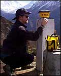
Dave Mencin sets up GPS gear on the trek to base camp.
(photo: Corfield)
| Summit Science Measuring the world's biggest mountain |
Dave Mencin sets up GPS gear on the trek to base camp. (photo: Corfield) |
The Himalayas are a result of the collision of the Indian Plate with the Asian Plate. A point in central India gets some five or six centimeters closer to Tibet each year. This closure results in mountain formation. This closure does not happen in one place in but across a region of deformation, and by measuring a line of points across this region to within 1cm (or less) we can get some idea of where things are happening and at what rate — for instance where does India turn under Tibet?
 Simonson and Wilson practice with the drill [click to zoom] (photo: Corfield) |
A secondary reason to survey in the summit of Everest is to complete a life long dream of Brad Washburn. Brad is both a famous surveyor and accomplished mountaineer who made his fame surveying, climbing, and photographing Denali in Alaska. Brad published definitive maps of both Denali and the Everest Region. We hope to put the final touch on his Everest map.
Since we have all this GPS equipment with us, and at the constant urging of Brad Washburn, we will also map most of the major features along the route. We will not do this to the same accuracy as the geodetic experiment but will get general ideas of the location of features such as all the camps, South Summit, bottom and top of the Hillary Step, etc. We will map most features to within 2 meters. To practice these techniques, the climbing team will be mapping out villages like Pheriche on the way up.
 The Trimble 4800 [click to zoom] (photo: Corfield) |
Weather
In conjunction with the Media Lab at MIT, we will be placing a
continuos weather stations at both the South Col and the Summit.
— Dave Mencin, Expedition Scientist
| SUMMIT SCIENCE | |
|
|